Large Area Mapping
Here's a single image made from 488 high quality photos showing 194 acres near Bellamy, Missouri. It's the Lodge of Hope from Peterson Outdoors Ministries.
Hit the plus sign (+) on the map below, and see how far you can zoom in and move around on the image. It has much more detail than the surounding Google Map, and shows the Lodge property exactly as it was on the morning of June 18, 2018. The 2-D image is fully measurable in area, distances, elevation & GPS points. The map is an accurate planning tool when estimating improvements like fencing, new roads or new buildings.
Mapping for Marketing
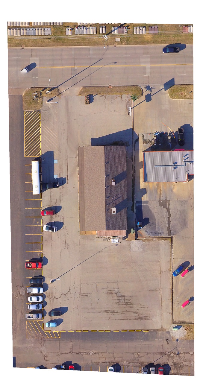
Here's map of a commercial property in Pittsburg, Kansas. It shows the lot's frontage, depth and rear width. This image was used in web video illustrating the building's high traffic location as well as it's proximity to other businesses & neighborhoods.
There are times your customers want more information than will fit in a 15 or 30-second TV ad. That's why more advertisers are spending less budget on traditional media & investing more in their digital or on-line advertising. A 3-minute web video can spotlight your products & services to the customers who are shopping.
Today's top strategy is to build up a variety of web videos about your business for posting on your website. It's still OK to advertise on traditional media, but it is most important that the media messages drive traffic to the website.
Videos & Pictures for the Internet
Todays on-line customers may be looking at computers, tablets, smart phones or smart TV's. It's important that your web content is easy to view on all devices. Optional services include posting your content to the internet and giving your web-site an update. We also create web-sites for our photo/video clients. Take a look at www.obrienreadymix.com.


Custom Crop Health Mapping
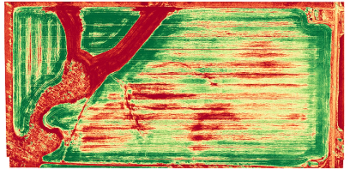
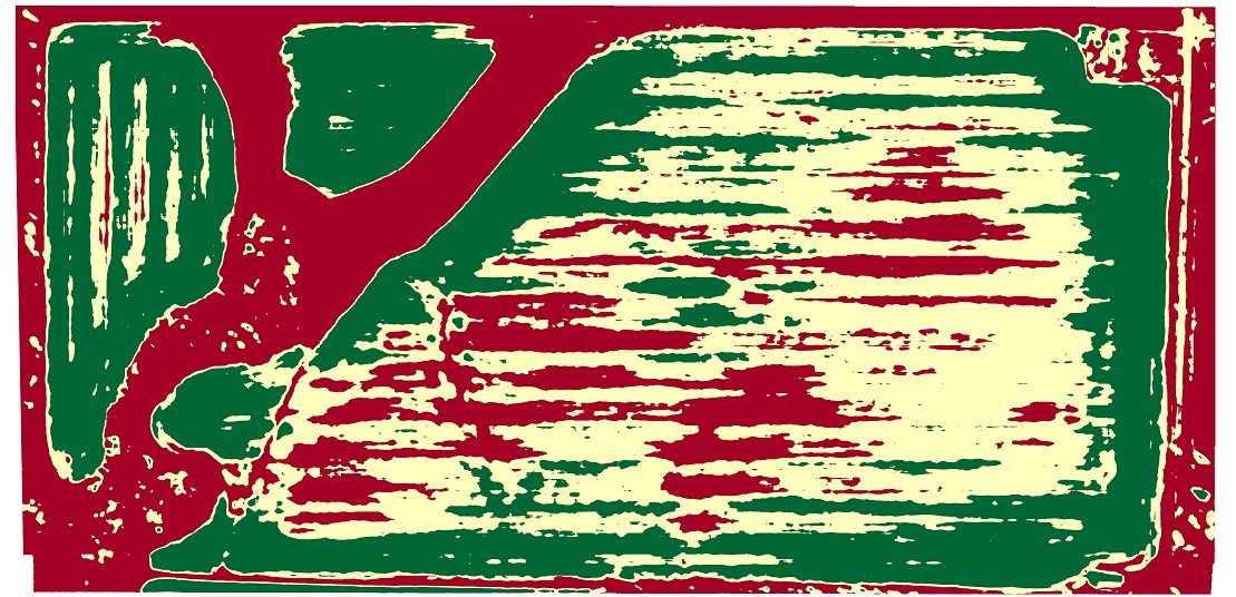
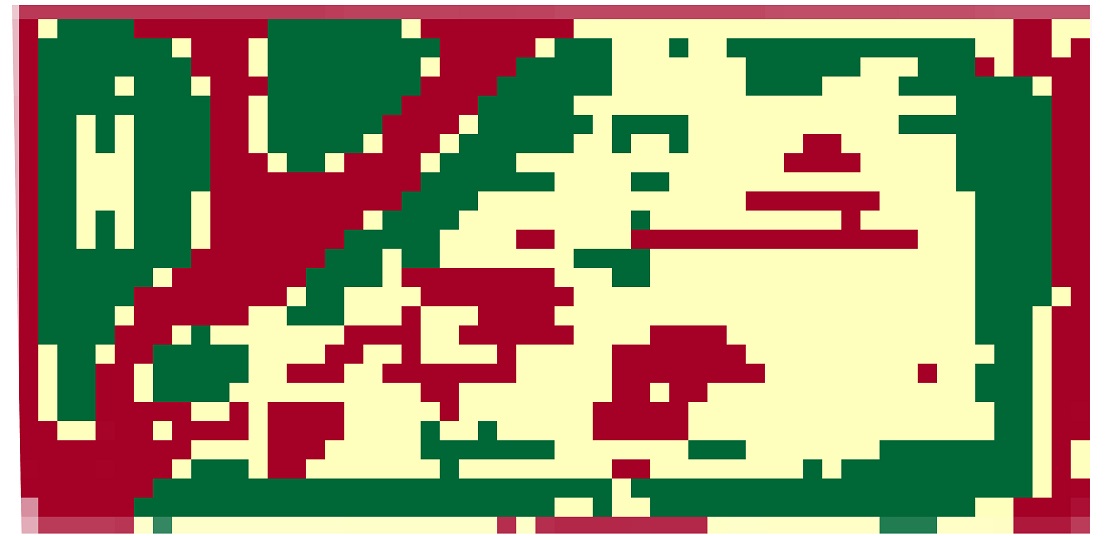
Every farm field has unique characteristics. No two fields are exactly the same, so why treat them the same? Above are Crop Health Maps of some winter wheat in Southeast Kansas. We can provide maps during the growing season showing healthy crops, plus areas of stress due to insects, mold, diseases, weather damage and not enough fertilizer. We can show the variations from field to field, and producers can apply costly chemicals and fertilizers at the proper rates. These images are the road map to "Precision Agriculture." The data is uesful for local crops including corn, wheat and even pecan groves. Producers get up to date views of their entire field, and the information can control custom vairable rate application equipment. If problems show up, the maps provide GPS points of where to look on the ground. This way, yeild-robbing issues can be addressed before they mess-up a whole field.

